For an adventure story, one doesn’t immediately think of a couple of surveyors setting up transits, taking sights, stretching chains, and marking out maps. That’s not to say that surveying as a trade doesn’t have its moments. The perfect triangulation that matches both coming and going could send a thrill down the staidest surveyor’s spine and cause him to toss his hat in the air. As a rule, however, surveyors were astronomers and cartographers and mathematicians who preferred quiet contemplation and exactitude rather than braving hazards.
Perilous places, however, could by chance be part of the job, which brings us to the story of a “thing” that is a piece of popular knowledge, something everybody has heard of, but often only as an abstraction. In fact, it is frequently remembered as nothing more than a symbol. An interesting experiment, in the spirit of those man-on-the-street queries, would be to ask a random assortment of people about the “Mason-Dixon Line” and see how many would be able to say what it is. More importantly, how many would know where it is?
For the “where" is quite significant. The Mason-Dixon Line did more than resolve a boundary dispute. It solved a pressing issue in real world relationships framed in the question “Where is there?” It is far more important to have that answered than “What is there?” The where must be resolved before the question that most people mistakenly ask first, which is “What happened there?”
The “where” in our story was the wilderness in which the proprietors of colonial Pennsylvania and Maryland lodged overlapping claims for almost a hundred years. These two of Britain’s North American colonies had been casually handed out by two kings of England, and even the brother of one had joined in the handing out fun. The recipients were glad to get the land and consequently didn’t put too fine a point on where it began and, more importantly, where it ended. North America was a big place, and there seemed plenty of acreage to go around. Eventually, however, vague boundaries became a precise problem between contiguous and competitive colonial establishments.
Vagueness is easy. Maryland’s 1632 charter, given by Charles I to George Calvert (aka the 1st Lord Baltimore), was for the land north of the Potomac River to the 40th parallel of latitude, which was supposed to be the southern border of colonial New England. Almost a half-century later, though, Charles I’s son, Charles II, paid off a debt by awarding an enormous North American land grant to William Penn that fell just north of Maryland. Aside from infringing on the land rights of New England, Pennsylvania’s southern border was said to be at the 40th parallel, but only after a fashion, because there was the problem of Delaware, formerly inhabited by the Dutch. The Calvert family said Delaware was part of Maryland under the 1632 charter.
This meant that the basis for the eastern stretch of Pennsylvania’s southern border was something called the “12-mile circle” centered at New Castle, Delaware. The method of using circles was a venerable surveying technique, but its usefulness was completely reliant on the accuracy of other factors. In this case, the circle wasn’t a circle, but a part of a circle whose northwestern arc was presumed by Charles II, and William Penn for that matter, to intersect the 40th parallel at some point. The idea was to start at that intersecting point and extend westward. The land north of 40° was Pennsylvania, and the land south of it was Maryland.
You probably think that this was complicated enough, but hang on. When surveyors started sorting things out to make the ground match the charters, they made a troubling discovery. The 12-mile circle doesn’t intersect the 40th parallel. It never even comes near the 40th parallel. Basing anything on the 12-mile circle wasn’t a benchmark but a formula for chaos. It made the eastern part of Pennsylvania’s southern border impossible to place, and it drew Maryland’s border so far north that Philadelphia would technically belong to the Calverts. As if these weren’t enough complications, Charles II’s brother, the Duke of York, gave Delaware to the Penns, causing the Calverts to raise a howl. The matter of who owned Delaware, like everything else, landed in court, and the eventual result was tiny Delaware became a separate colony, somewhat by accident, but not before killing any compromise to resolve the Pennsylvania-Maryland border.
In the aftermath, it proved impossible to resolve the controversy. Year after year passed with a series of tedious claims, counterclaims, and judicial proceedings coinciding with multiplying maps. Not until the 1730s did one of the lawsuits finally form the basis for a possible settlement. The Privy Council Committee for Plantation Affairs in London ruled that the border dividing Maryland and Pennsylvania should be changed from the 40th parallel to one running along 39º43’32”. This placed it about 50 miles south of 40º.
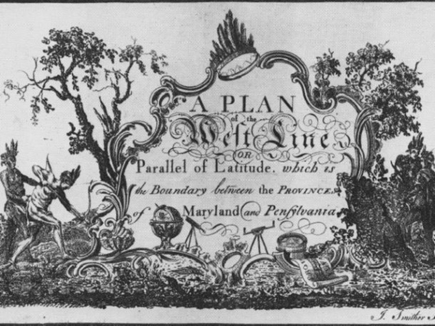
Fair enough, said the Calverts and the Penns. The court helpfully provided a small map to mark the “where” of this “there.” This document, which became known as “Lord Baltimore’s map,” was printed on all deeds relating to the dispute, and the issue seemed settled, at least on paper. In real life on the real ground, it wasn’t settled at all, not for the people living there. Those claiming to be in Maryland and their counterparts thinking themselves in Pennsylvania were always disagreeing about their whereabouts and sometimes violently. Quarrels between these pioneering settlers on this tricky degree/minutes/seconds border got out of hand at the drop of a coonskin cap.
This real world question of “where is there?” was threatening to cause a little civil war, and that finally forced the Penn and Calvert descendants to execute yet another deed in 1760. It called for the latitude to be accurately surveyed, prominently marked, and thereby given tangible proof on the ground that standing in a particular spot put you in Maryland and stepping just one pace north of that spot put you in Pennsylvania. They hired the best surveyors in North America to get to the bottom of things.
They weren’t Mason and Dixon; rather they were Lukens and McClean. John Lukens was the surveyor general for Pennsylvania and accordingly competent, and Archibald McClean was equally so. McClean had six brothers, all but one a surveyor, and they signed on for the job as well to become colorfully known in the lore of the region as “The Seven McCleans,” which sounds a bit like a Broadway musical. But there was nothing harmonious about their labors, which is the reason we don’t speak of the Lukens-McClean Line. Lukens and McClean were Pennsylvanians, and the Calvert family understandably insisted on having Maryland represented on the surveying team too. Disagreements consequently plagued almost every step of the work from establishing where the center of the 12-mile circle was to sighting the exact location of Cape Henlopen. After three years of wrestling with these problems and one another, the colonial team called it quits.
The Maryland and Pennsylvania proprietors concluded that the problem was a lack of collaboration rather than competence, so they resolved to hire outsiders who had no interest in advancing one province over the other. To focus exclusively on the precise place of the boundary, though, they did want the most talented surveyors they could find. It was a pricey proposition, but the proprietors agreed to pay the bill and cover costs, including travel and the purchase of the best equipment then available. And that was why in August 1763 they brought Charles Mason and Jeremiah Dixon from England to check the Lukens-McClean survey and complete it.
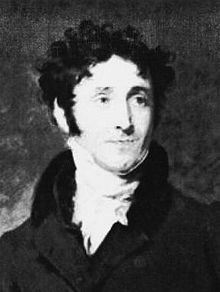
Jeremiah Dixon
They were young men — Mason was 35 and Dixon was 30 — which was fortunate because they would be physically tested in America. Mason’s first love was astronomy, and the bulk of his work had been at the Royal Greenwich Observatory outside of London where he labored on lunar tables to help mariners calculate longitude more precisely. Dixon was from a wealthy Quaker family that had made a fortune in coal mining, but Jeremiah’s stargazing became more than a hobby, and his dexterity with difficult mathematical problems gained notice. The two met in 1761 when they were jolted from their respective armchairs by the Royal Society, which sent them to Sumatra to watch Venus pass across the sun. When they couldn't reach Sumatra in time, they resourcefully made their observations from the Cape of Good Hope, and that sort of agility in dealing with the unexpected was the very thing the proprietors were looking for.
Mason and Dixon arrived in Philadelphia in November 1763 as seasoned travelers, and they must have enjoyed the sort of fellowship that comes from shared experiences in exotic locales. But we know little about them outside of their work. Considering that work’s quality, it isn't a bad way to be remembered.
They began immediately with the construction of an astronomical observatory on Cedar Street in Philadelphia, so they could accurately fix the latitude of the southernmost point of the city. They went to New Castle to verify the center of the 12-mile circle and check the lines run by their American predecessors, including a tangent line down the Delmarva Peninsula. And finally, they set a corner stone to begin running their own line to the Susquehanna River. That was when their real work began with the start of the “Mason-Dixon Line.” The best boundaries are based on geographical features such as rivers, but Mason and Dixon were breaking new ground by not breaking any physical ground at all. Their boundary would be unique in establishing a mathematical abstraction, an invisible line formed along a parallel of latitude that wasn’t even rounded off but was a granular figure of 43’32” south of the 40th parallel.
The complexity of that chore is worth thinking about, especially if one is thinking about the year 1764. The journals of their expedition prove their diligence, but they also reveal a level of exactitude that is nothing less than marvelous considering the nature of their equipment, the pitfalls of the terrain, and the perils the people on it posed, especially vaguely angry Indians. These two Englishmen plopped down in this trackless place and given this difficult chore were of that generation’s pocket-protector set, nerds in the modern nomenclature, but they approached every difficulty with nonchalance and poise. An improvised negotiation with Iroquois chieftains added Indian guides and interpreters to their already sizable party of chain-bearers, sutlers, cooks, woodsmen, servants, and laborers, making Mason and Dixon the captains of a lumbering expedition as diverse as it was imposing. Everyone watched with varying levels of boredom and impatience as the two fellows sighted stars, scribbled notes, took bearings, scribbled more notes, and spent hours leveling a theodolite.
They then slogged in sunshine, rain, or sleet across impossible country to the next point, which sometimes was only several yards ahead. “The tremor of the air, caused by the sun’s rays,” they noticed, “was often very great.” It made sighting the marks on poles an iffy proposition, so they sighted each a dozen or more times and at different times of day. Taking a single sight line could consume hours. Sometimes it took days.
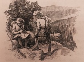
David Montogomery’s popular reference text The Leading Facts of American History in the 19th century imagined Mason and Dixon at their work.
And the days added up. Winter weather also forced stoppages, but by October 1767 they were standing on top of a small mound when their Indian guides refused to go any farther west. Doing so, they said, would take them beyond British territory. The place would be called Brown’s Hill, and it was fated by Indians rather than the surveyors to be the terminus of their Mason-Dixon Line. Their boundary ran 230 miles, 18 chains, and 21 links from its starting point. In the course of their work, they had placed stones at intervals to make their abstraction tangible, and a goodly number of these markers still exist. When their locations were checked in 1849 with superior instruments in what was then much tamer territory, the army surveyors were pulling out pocket rulers to measure variations as they shook their heads in amazement. The Mason-Dixon Line has been rechecked several times in subsequent years with tools of increasing sophistication, and admiration has only grown. Errors of placement are often in feet rather than yards, and most often in inches rather than feet. What is most startling is that the two Englishmen knew about these errors at the time when they took the trouble to resurvey the line back from the stopping place to the starting point. They were periodically disturbed by winding up slightly off from where they should have been, especially because the errors were not random but embarrassingly predictable.
They wondered if they could have been sloppy after all. Had fatigue thwarted their obsessive aim for accuracy? No, suggested a learned friend in England; it was something beyond their control, and Mason and Dixon slapped their hands to their foreheads at the revelation. The greater gravitational mass of the Allegheny Mountains had pulled their plumb-bobs imperceptibly off true level. It caused systematic rather than random sight errors, which could be much less than 1/64th of an inch at a sight of one full chain of 66 feet but was ever so slightly increased by distance. It didn’t matter in 1767 as far as their employers were concerned, even if it left Charles Mason and Jeremiah Dixon frowning over their notebooks. Neither man was ever reconciled to anything but perfect accuracy.
It’s the reason that everyone has heard of their line, even if relatively few know what it is, where it is, and who was responsible for it. Mason and Dixon left America in 1769 and never worked together again, but they continued the perplexing labors of making mathematical sense of the heavens and the earth. Mason continued to perfect lunar tables and tackled the problem of measuring gravity. Dixon traveled to Scandinavia to observe another transit of Venus and eventually returned to the place of his birth where he amused himself in quiet retirement with surveying chores for wealthy neighbors. He was a Quaker, but he didn’t dress like one, and he was known to enjoy a glass of scotch on occasion. He never married, but when he died in 1779, he left a considerable estate to Margaret Bland, who had two daughters. Possibly Jeremiah Dixon was less Quaker-like in matters other than attire and alcohol.
Mason, on the other hand, was married twice and had many children. The financial burdens of a large family for even a talented scientist in the 18th century were onerous, and he seems to have run through even the most generous commissions. The shadows of mystery matched those of poverty when he returned with his large family to America, by then the United States, in July 1786. He had an astronomical project he wrote about to his friend Benjamin Franklin, but Mason was not only impoverished but ill. He didn’t last until November.
In a final irony, both of these men, who were obsessed in life with the meticulous marking of where things are, were buried in unmarked graves. Later generations would correct the oversight, though nobody is quite sure to this day where Charles Mason is buried in Philadelphia’s Christ Church Cemetery.
The ignorance born of our sloppy inaccuracy is of no consequence. Mason and Dixon always knew exactly where they were. There’s no reason to think that has changed.